
Editor’s Note: State and federal leaders have acknowledged that the Chesapeake Bay region will not meet its most fundamental 2025 cleanup goal: reducing nutrient pollution in the Bay and its rivers. Now, many people are asking, “How did we get here?” and “What’s next?” This article is part of an ongoing series that tackles that question.
For 40 years, the Bay region has struggled to sufficiently reduce nutrient pollution from farms. The reasons are complex. But it’s important to explore those challenges as the region begins a tough conversation about the future of the Bay restoration effort beyond 2025.
Previous articles in this series explore difficult trade-offs with agriculture, the challenge of setting realistic goals and the dearth of technical support to help farmers with conservation projects.
ANNAPOLIS, Md. – The state-federal Chesapeake Bay Program had a clear message for farmers in September: Their runoff control efforts are accelerating and helping to clean up the Bay.
What’s actually happening? That’s far less clear.

The Bay Program’s report on pollution reductions did, indeed, show that farmers have increased the use of cover crops, stream buffers and other practices that would reduce nutrient-laden runoff fouling the Bay and its rivers.
But the report did not include other data indicating that fertilizer sales and farm animals have increased, both of which can add to pollution loads. Had that information been incorporated, the conclusion might have been quite different: It could have offset most progress made by recent runoff control efforts.
Such conflicting information frustrates people in the agricultural community, from individual farmers to state-level department heads. It contributes to a loss of confidence in the Bay Program, as well as the computer models it uses to set cleanup goals and gauge progress.
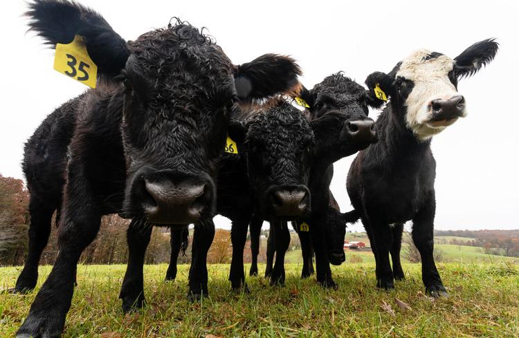
It’s a significant issue. Agriculture is the largest source of nutrient pollution to the Chesapeake, and states are relying on farmers to achieve the overwhelming majority of nutrient reductions needed to meet Bay goals.
But those largely voluntary actions often cost farmers money, increase their workload and reduce productivity, which in turn hurts future income. Uncertainty over what is expected of farmers and whether their actions are making a difference can make it more difficult to get people to act.

State agriculture secretaries made that point last year in a letter to Adam Ortiz, administrator of the Mid-Atlantic region of the U.S. Environmental Protection Agency, complaining about “mixed messages that are quite discouraging for our farmers.”
“Continued confusion could erode confidence and trust between cooperating parties and the science we rely upon to guide our investments,” they wrote.
Bay Program records show that state and federal agencies have spent more than $2 billion to help reduce runoff from farms over the last decade. But it remains unclear what has been achieved, at least in computer models used to assess progress.
Officials have already acknowledged that the Chesapeake region will miss its self-imposed 2025 deadline for reducing nutrient pollution in the Bay. And people in the farm community worry they will get the bulk of the blame.
In their letter, the agriculture secretaries insisted that farmers are doing more than they are credited for and that model results “seem at odds with the water quality improvements we have observed.”
Not everyone agrees. Some in the academic community suspect the Bay models may overestimate, rather than understate, the impact of farm runoff control efforts.
But most agree that confidence in the models is critical.
If farmers don’t believe in the system, they are less likely to spend money and take measures that may not be in their best economic interests, said Dan Nees, who worked for decades with the University of Maryland and others to find effective financial strategies to improve the Bay.
“The bottom line is that trust is not there,” Nees said. “Until we figure out how to solve that, it doesn’t matter how much money you put out there.”
The virtual Bay
Efforts to understand the Chesapeake ecosystem through models date to the late 1970s, when the U.S. Army Corps of Engineers began designing and building an 8-acre, three-dimensional model of the Bay.
Carved from concrete and filled with water pouring in from simulated rivers, it helped provide an understanding of complex water movements within an estuary where rivers and ocean water mix.
Since then, modeling has become an indispensable part of the Bay cleanup effort. The 8-acre model has long since been replaced by sophisticated computer simulations that drive decisions about how billions of dollars are spent.
The Bay Program relies on four models:
- An airshed model, which estimates the amount of nitrogen (a nutrient) deposited directly on the Bay and its watershed from air pollution
- A land use model, which predicts the nutrient impact of development, human population and changes in agricultural land use, such as shifts from pasture to crops
- A watershed model, which estimates the amount of nutrients that reach the Bay from all of the activities in its 64,000-square-mile drainage basin
- An estuarine model, which estimates the impact that changes in nutrient inputs will have on Bay water quality
Nutrients spur algae blooms that cloud the water, blocking light essential for underwater grasses, a critical habitat for fish, crabs and other species. When algae die, their decomposition removes oxygen from the water, leading to “dead zones” that are off-limits to aquatic life.

When the EPA established its Chesapeake Bay total maximum daily load, or “pollution diet,” in 2010, it relied on models to estimate the amount of nutrients (nitrogen and phosphorus) that must be reduced to clear the water and eliminate dead zones.
The modeled answer: The amount of nitrogen reaching the Bay needs to be slashed from 270.8 million pounds a year, measured from a 2009 baseline, to 199.3 million pounds. Phosphorus needs to be cut from 17.17 million pounds to 12.86 million pounds.
The models were then used to divide the needed nutrient reductions among the states and major rivers.
States used the models to write cleanup plans outlining the number of wastewater treatment plants that needed to be upgraded and the amount of nutrient-reducing best management practices, or BMPs, that were needed to meet the goals. In agriculture, BMPs include things like nutrient-absorbing cover crops, stream buffers and no-till farming.
Each year, states report on their actions, and the models use that data to estimate cleanup progress, which is then publicly reported. It is hard, therefore, to overstate the region’s reliance on models to drive cleanup efforts and evaluate results.
“You absolutely need a model to be able to do those things,” said Zach Easton, a Virginia Tech computer modeler who has participated in several reviews of Bay Program models. “But we have put all our eggs in the watershed model basket, and we don’t at this point have a way around that.”
A watershed of data
When people talk about “the model” — especially if it’s a complaint — they are usually referring to the watershed model. It is the primary tool used to drive cleanup plans and the yardstick for measuring progress. As such, it plays a major role in shaping public perception.
It uses a massive amount of data and predicts water quality improvements in the Bay that are often difficult to confirm through monitoring programs because the results of many actions taken today won’t be measurable in waterways for years.
That level of uncertainty makes the model a target for criticism, and views of the model are often shaped by whether it produces results people like.
For instance, in their letter, which questioned model results, the agriculture secretaries said, “We trust estimates that suggest agriculture has contributed significantly to reducing runoff and nutrient contamination.”
Measuring reductions from wastewater treatment plants is relatively easy. Nutrient levels are measured in discharge pipes (hence their name, “point sources”), and their impact is seen quickly in waterways.

But for nonpoint sources such as farms or developed lands, such direct measurements are difficult. Nutrients can reach waterways through many different routes, over long periods of times. And nitrogen and phosphorus behave differently.
Much of the nitrogen sinks into the ground and is transported to streams through slow-moving groundwater, a journey that can take years, or decades.
Much of the phosphorus bonds with sediment. It is pushed off the land during storms but can be stored in streams for years before a large storm washes the sediment and attached phosphorus farther downstream, where it is deposited again, waiting for another storm.
Also, many BMPs designed to reduce nutrient loads, like streamside forest buffers, take years to become fully effective.
Because of such lag times, the watershed model is a critical tool for estimating the future impact of nutrient reduction actions taken today. But modeling such complex dynamics is an enormous challenge, dependent on the amount and quality of data that’s fed into the system.
Model predictions have a profound impact on the region’s farmers, who are being asked to achieve more than 90% of future nutrient reductions.
Collectively, wastewater treatment plants across the region have slashed their discharges of nitrogen by more than 25 million pounds since 2009 and have achieved their 2025 goal. But most plants have now been upgraded, and few additional reductions are expected from them.
On agricultural lands, runoff controls only produced an 8.9 million pound nitrogen reduction during the same time period, according to model estimates.
But those lands generate almost four times as much nutrient pollution as wastewater plants. At the rate of reduction since 2009, farms would not reach their collective Bay cleanup goals for many decades. So, if the model predictions are correct, farmers face a huge challenge.
But predicting impacts from agriculture is particularly difficult. Farms cover a large area of the Bay watershed and include a range of operations, from small organic produce farms to massive poultry and dairy operations.
Over time, those farms have produced greater amounts of crops and meat, which can demand more fertilizer and animal feed. At the same time, agricultural advances have made many operations more efficient, so they require fewer inputs for each bushel of corn or pound of meat produced. And the use of runoff control practices has increased.
Accurately assessing nutrient inputs and outputs from these competing factors is challenging — and it’s typically at the heart of disagreements over modeled agricultural impacts.
Real perceptions
That was clearly on display Sept. 26. That day, the Bay Program released its nutrient reduction update for 2022, based on information reported from the states.
Model results showed that 85% of nitrogen and 98% of phosphorus reductions reported during that year stemmed from actions taken by farmers.
In an EPA press release, regional administrator Ortiz, who has been working hard to improve the agency’s relationship with farmers, said “the story of the past two years is one of tremendous improvement, especially in the agricultural sector.”
Yet that same day, Ortiz chaired a meeting of senior state and federal Bay officials to determine how to include uncounted information in the computer models.
While the models are updated annually with information about nutrient reduction efforts, they are also periodically updated with data that could show an increase in nutrients, such as changes in land use, crop production, farm animal numbers and fertilizer sales.
That was scheduled to happen two years ago, but many state officials balked at the new data, as it would erase millions of pounds of nutrient reductions, mainly because of increases in fertilizer sales and a growing farm animal population.
The “unaccounted additional loads” total about 9.9 million additional pounds of nitrogen and nearly 80,000 pounds of additional phosphorus — although the modeled numbers are still being finalized and could shift slightly.
Bay Program partners agreed at the meeting that states will not have to address those increases until after the 2025 deadline.
But it reveals how modeled numbers influence perception. After telling the public that farmers are making “tremendous” progress, the future adjustments seem likely to erase most, if not all, of the model-estimated 8.9 million pounds of nitrogen reductions credited to farms since the TMDL went into effect.
The conflicted messaging, in which farmers are credited for progress only to have it taken away, has frustrated those in the farm community for years.
Chris Thompson, director of the Lancaster County Conservation District in Pennsylvania, which is the most intensive agricultural county in the Bay watershed, said he understands the need to incorporate new information into the model. But because of such changes, “the general public sees [Bay goals] as a moving target that we will never hit.”
“When there’s an article that talks about the model being reassessed, reassigned, recalibrated, it makes it very difficult to build confidence that, no matter what we do, we will ever clean up the Bay,” he said.
As a result, he asks farmers to think about the benefits to nearby streams and rivers. “The messaging that we focus on is fixing our local water,” Thompson said. “When improving the Bay comes up, the model is held suspect by almost every level of the community.”
Data dilemma
Much of debate over the model is less about the model than it is about the data.
The usefulness of the fertilizer figures that triggered much of the “unaccounted” nutrient loads have been debated for decades because of questions about whether sales data accurately reflects when or where purchased fertilizer is actually used.
“I am gravely concerned about agriculture’s ability to meet our TMDL goals, not because I don’t think that conservation is happening on the ground, but because we are being tasked with overcoming a commercial fertilizer assumption that is vastly overstated,” said Lindsay Thompson, director of the Maryland Grain Producers Association and a former member of the Bay Program’s Agriculture Workgroup.

Meanwhile, she and others contend that the model underestimates yields of corn, the largest crop grown in the watershed. Higher yields would soak up more fertilizer, leaving less to potentially run off.
Much of the data about crops and animal populations comes from the U.S. Department of Agriculture, but it is collected for other purposes and the level of detail often varies from state to state.
It also may have omissions. For instance, the largest concentrated animal feeding operation in Pennsylvania’s portion of the Bay watershed has 5.5 million egg-laying chickens and produces about 5 million pounds of nitrogen a year — but it is apparently not included in the USDA data used by the Bay Program model.
Such data concerns are not new. A 2007 report prepared for the Bay Program warned that the agricultural information available for decision-making was poor and could get worse in the future.
Mark Dubin of the University of Maryland, who is the Bay Program’s senior agricultural advisor, said that while progress has been made, the Bay Program still lacks significant dedicated funding to improve data.
Too often, he said, that means it must extrapolate from national data, draw on decades-old information or rely on studies conducted in other places.
The models are so complex that there is often a drive to aggregate data and reduce specificity. But, Dubin said, making the effort to include more precise information is important to building confidence.
“In the grand scheme of things, maybe it’s not significant,” he said. “But I think having those elements represented is part of the key factor for trust. If producers look at what we’ve done and they don’t see what they’re doing represented, it just calls everything into question.”
Counting BMPs
Another model data uncertainty, and point of dispute, involves BMPs.
The Bay Program recognizes more than 200 BMPs, and each is assigned a nutrient reduction value derived by a team of experts. But they often have limited research to draw upon. And a nutrient reduction value may not reflect all of the varied soil, geologic and hydrologic conditions throughout the Bay’s huge watershed. In fact, their effectiveness may vary from place to place on the same farm.
“Estimates of achieving TMDL targets generally assume that expected pollutant responses to BMP implementation are accurate,” a recent report from the Bay Program’s Scientific and Technical Advisory Committee, or STAC, states. “Given the complexity and uncertainties of reducing pollutant loads across a large watershed, this will rarely be the case.”
Not only is it unclear how well BMPs perform, it’s also unclear how many are on the landscape.
Early on, Bay Program datasets were plagued with overcounted BMPs. At one point, state-reported data showed more acres under nutrient management plans than actual crop acreage in the watershed.
Over time, the Bay Program has improved the quality control of data and developed complex procedures about what is counted and how. BMPs must be periodically “verified” to ensure they still exist or they are removed from the data.

But that is a time-consuming process that many in the farm community say leaves out a large number of practices that exist and function. Also, actions taken by farmers without government cost-share funding are not in the databases because agencies have no record of them.
And if a farmer takes an action that fails to fully meet the Bay Program’s design specifications for a BMP, such as a minimum width for a streamside buffer, the practice gets no credit, even though it may have some lesser benefit.
“We have farmers that have already fenced off their streams, but it might not be up to the specs that the state has set, so you can’t count those, even though there’s no cows in the stream,” said Lynn Graves, a farmer and chair of the Culpepper Soil and Water Conservation District board of directors in Virginia. “There’s more out there than we think there is. But it’s not getting credit.”
What’s real?
Those uncertainties contribute to skepticism of model results.
Dartmouth University researcher D. G. Webster conducted interviews with 59 people deeply involved in the Bay cleanup process in 2021 and found “the vast majority of comments evaluating the model and/or the modeling process were negative.”
Her interviews found “no statements indicating enthusiastic acceptance of the model or the modeling process.” Most thought the model was undercounting progress toward nutrient reduction goals.
That is counter to what many in academia think — that it overcounts nutrient reduction progress. “Data indicate that efforts to reduce nonpoint source loads are not as effective as expected,” the Bay Program’s STAC, said in a recent report.
It’s hard to directly compare model predictions with actual water monitoring data because of the time lag between when actions are taken and when they actually affect water quality.
The watershed model predicts the direction of nitrogen trends fairly well in most major rivers. That coherence sometimes disappears in smaller watersheds, though.
For instance, in the agriculturally intensive upper Choptank River in Maryland, monitoring shows that nitrogen is increasing while the model predicts an overall reduction.
For the Conestoga River, which drains much of Pennsylvania’s farm-intensive Lancaster County, monitoring shows greater nitrogen reductions than the model has predicted.
More concerning is phosphorus. For years, the model has been showing that the region is well on track to meet reduction goals. But that predicted success is not reflected in most rivers. Monitoring shows that the regional trend is flat or decreasing only slightly. The phosphorus results are particularly concerning, STAC noted, because they have led states to focus largely on nitrogen.
“There’s substantial evidence out there, certainly for phosphorus and probably to some extent for nitrogen, that the model isn’t right,” said Virginia Tech’s Easton.
But no model of such a complex system is exactly “right.” Other models beyond the Bay Program evaluate the impact of land-based actions on waterways. Each have their strengths and weaknesses and paint slightly different pictures.
A widely used model by the U.S. Geological Survey estimates fewer nutrient reductions from agriculture than the Bay Program’s model. But a model used by the USDA in the past has shown greater reductions from farms. (Portions of those models are incorporated into the watershed model).
But there is no perfect model. STAC, in its most recent model review, said it was “favorably impressed” with the overall framework of the model but also called for the Bay Program to use multiple models to improve confidence in results, much as the weather service does in making predictions. That’s often been resisted, in part because of concerns that people will veer toward models that make them look best.
“I don’t know that you’re ever going to get around the model-shopping phenomenon,” acknowledged Easton, who still favors the multiple-model approach. “Certainly not when it comes to crediting water quality BMPs.”
Building confidence
Improvements are expected in the next major overhaul of the watershed model, slated for 2027. “Ideally, we’ll get a better handle on the input data,” said Easton, who chairs a Bay Program workgroup striving to improve agricultural estimates in the next model version. “Data is a big limitation with the modeling system and decisionmaking.”
Other improvements include new efforts to improve model alignment with water monitoring data by trying to adjust for lag times. Such efforts are underway and, in some cases, that seems to provide a better match between the model and monitored observations of nitrogen, but phosphorus remains problematic.
How far such efforts will go toward building trust in the farm community remains to be seen.
Ken Staver, a farmer and a scientist with the University of Maryland Wye Research and Education Center, has been involved with the Bay Program and the modeling effort for decades.
He generally considers the watershed model to be high quality but said that some of its simulations for agricultural land get simplified to the point that people don’t believe the results.
“All the states have to be able to buy in and go back and sell it to their farmers,” Staver said. “You have to have faith that the cost you’re going to inflict is going to get the result that you want.”
It’s a critical issue. How accurate should a model be to persuade a small dairy operator, who has seen milk prices drop by a third in the past year, to embrace even more economic hardship for the health of a bay 100 miles away? For now, that question is unanswerable.
Getting “right” model results for a vast watershed will always be a challenge. “It’s just a very dynamic system,” Dubin said. “It’s changing every day. We’re probably short in one area and probably over in another. In the end, does it balance out? That’s the question. We still really don’t have a good answer for that.”

Too many factors to expect farmers/ag to take the blame or be the solution. Are we counting inputs from residential areas? Homeowners fertilize lawns but often incorrectly. Treatment plants have failures and dump millions of gallons of sewage into waterways. Development increase potential for more runoff and pollution. Maryland is 12,000 square miles. The Chesapeake Bay watershed is 64,000 square miles.
‘THEY’ only use the stats that ‘THEY’ choose, those that make their research grants flow better and ignore the stats that disprove their claims.
While our counties and cities continue to dump (sorry…”overflow”) tens of thousands of gallons of raw sewage into the Bay every good rainstorm, what good will putting this onus on the farmers do?
It’s time to hold our elected leaders accountable, and stop allowing funds to be used on projects that keep them in office, and instead use it towards the common good of keeping sewage out of the Bay.
As long as the powers that be allow unfettered growth in the Bay watershed, with the wholesale destruction of forests and flood plains that slow and filter run off, the bay clean up will continue to lose ground. If we must grow we must do it holistically instead of continuing with the status quo of barren, car centric developments.